Laser Scanning Surveys
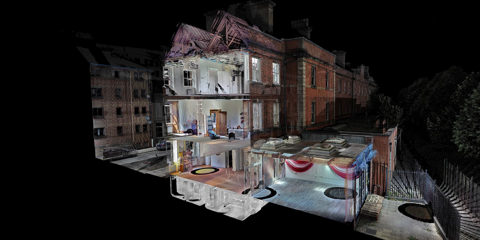
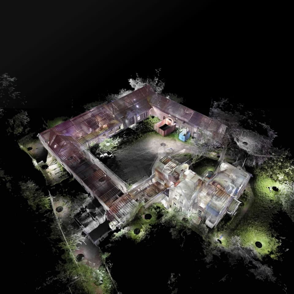
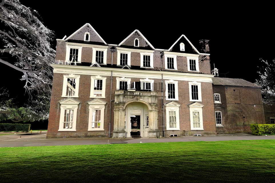
PointBIM provides high-accuracy 3D laser scanning surveys and fully registered point-cloud data in varitey of formats, principally - E57 & RCP. Laser scanning offers millimetre-level measurement across complex sites and is the foundation for dependable CAD, BIM and heritage documentation. Each survey captures a detailed digital record of existing conditions — suitable for measured drawings, Revit modelling, or standalone as-built data.
Benefits of
3D Laser Scanning
Laser scanning is now standard for refurbishment, heritage and complex building projects.
Key benefits include:
- Accuracy – Millimetre-level measurement across large areas.
- Efficiency – Rapid on-site capture compared with traditional methods.
- Safety – Minimal access required, reducing time on scaffolding or in restricted areas.
- Versatility – Point-cloud data can be processed into Revit, AutoCAD, or other formats as required.
Laser scanning supports design, coordination and documentation, providing a reliable record of the building as it stands.
Where Laser Scanning Adds Value
We regularly provide laser scanning services for:
- Refurbishment & fit-out projects
- Heritage and conservation documentation
- Building extensions and façade surveys
- Industrial and plant environments
- Asset management and maintenance planning
Laser scanning ensures that all subsequent measured surveys, CAD drawings and BIM models are based on accurate, verified data.
Deliverables
- Registered point cloud (primary output) – unified, colourised and aligned dataset (E57 or RCP).
- Mapping to grid or local datum – OS or site-based reference as required.
- Optional outputs:
- 2D CAD drawings (floor plans, elevations, sections)
- Revit or IFC model creation
- 360° photographic reference tours
All deliverables are verified internally before issue, ensuring compatibility with Revit, AutoCAD and other design platforms.
Why Work With PointBIM?
- Over a decade of laser-scanning experience across heritage, commercial and residential buildings
- Direct coordination with architects, engineers and contractors
- In-house processing and modelling for fast turnaround and consistent results
- Flexible scope — from single structures to large multi-building estates
Frequently Asked Questions
A laser scanning survey captures a building or site using 3D laser measurement to produce a detailed point-cloud model.
CASE STUDY PROJECTS
CASE STUDY: Boston Manor House, Brentford
PointBIM delivered a full-colour terrestrial laser scan of Boston Manor House and its immediate surroundings. The colourised point cloud and registration framework provide a reliable baseline for conservation work, measured drawings, and downstream BIM modelling.
Learn More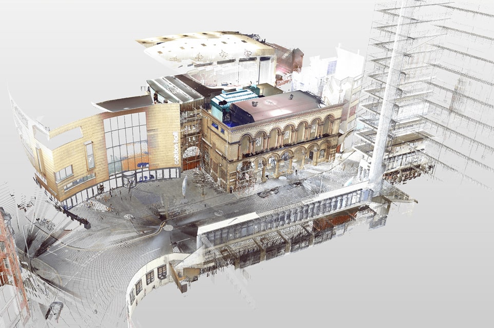
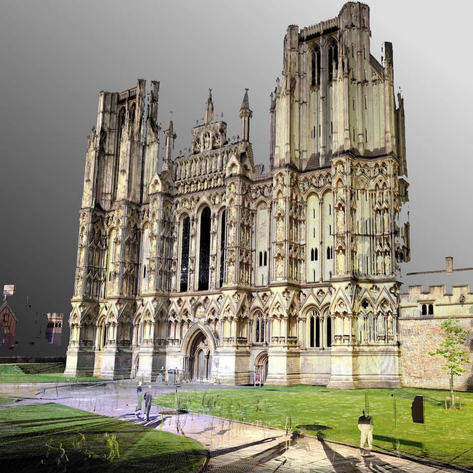
CASE STUDY: Bristol Beacon
PointBIM carried out a colour terrestrial laser scan of the historic front entrance to Colston Hall—now Bristol Beacon—to capture a reliable record of the façade, foyer threshold and immediate streetscape before refurbishment.
Learn MoreGet a Laser Scanning Survey Quote →
Send us any drawings and site address - we’ll confirm price, scope and turnaround within one working day.
For direct enquiries: