Measured Building Surveys
PointBIM provides accurate Measured Building Surveys and Scan to CAD drawings across the UK. Using high-resolution laser scanning, we capture existing buildings and produce reliable 2D drawings for design, planning and refurbishment projects.
Our process ensures every drawing reflects the building as it stands, giving architects, engineers and contractors dependable data from the start.
What are
Measured Building Surveys for?
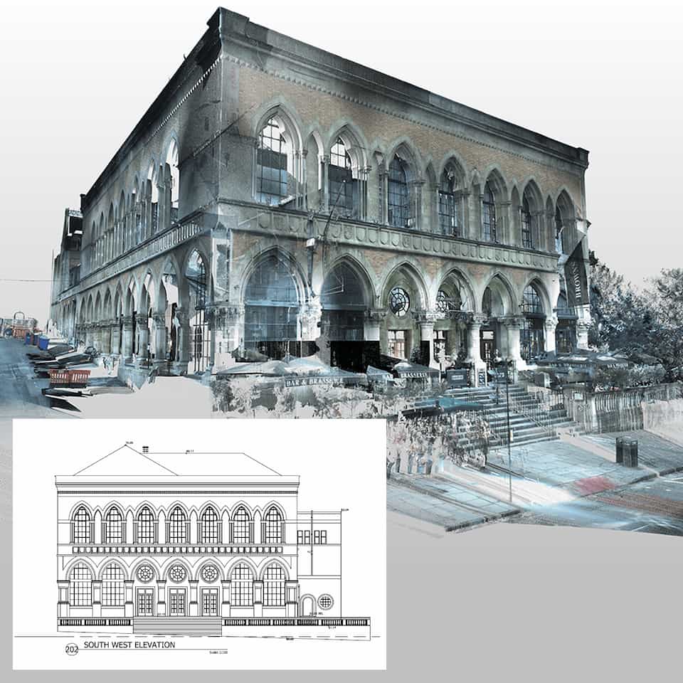
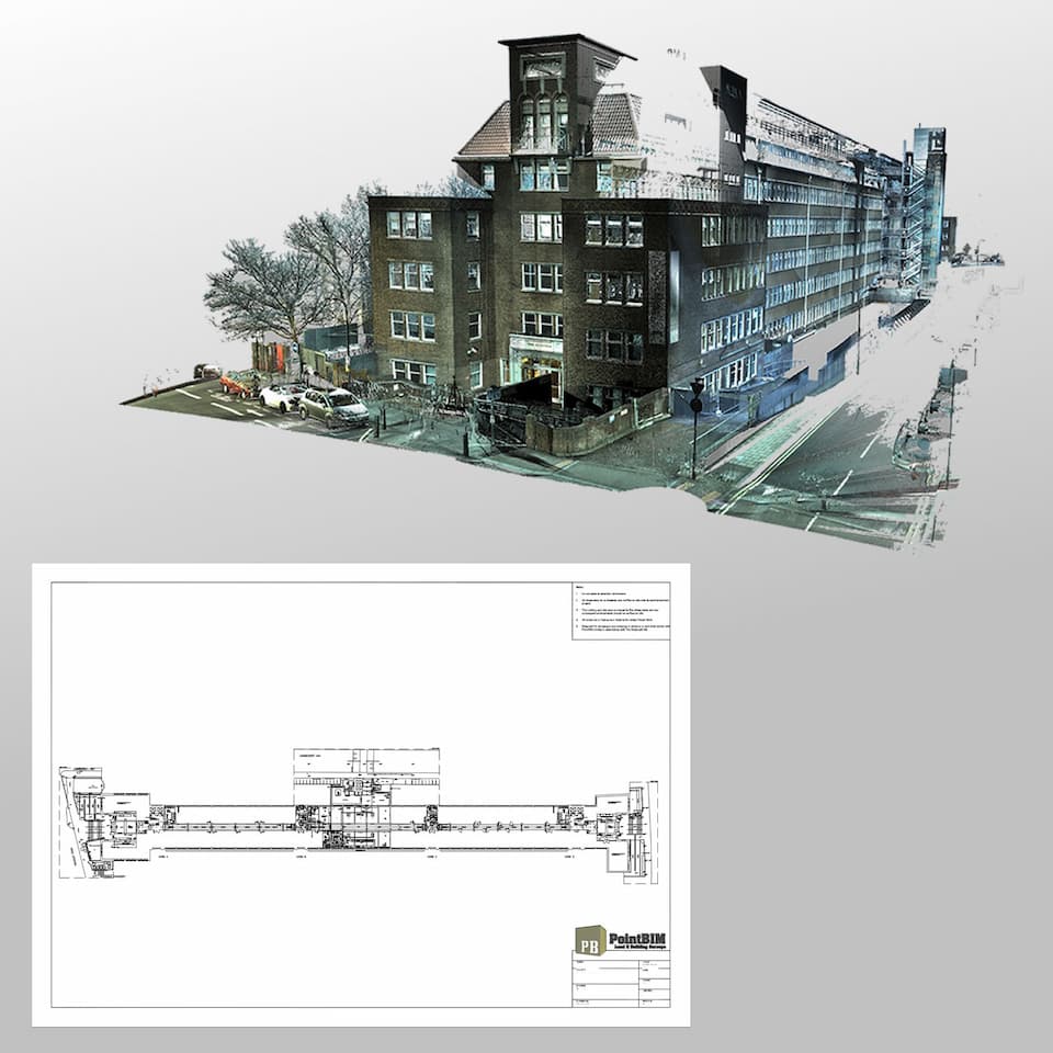
A measured building survey records the exact dimensions and features of an existing property using laser scanning technology.
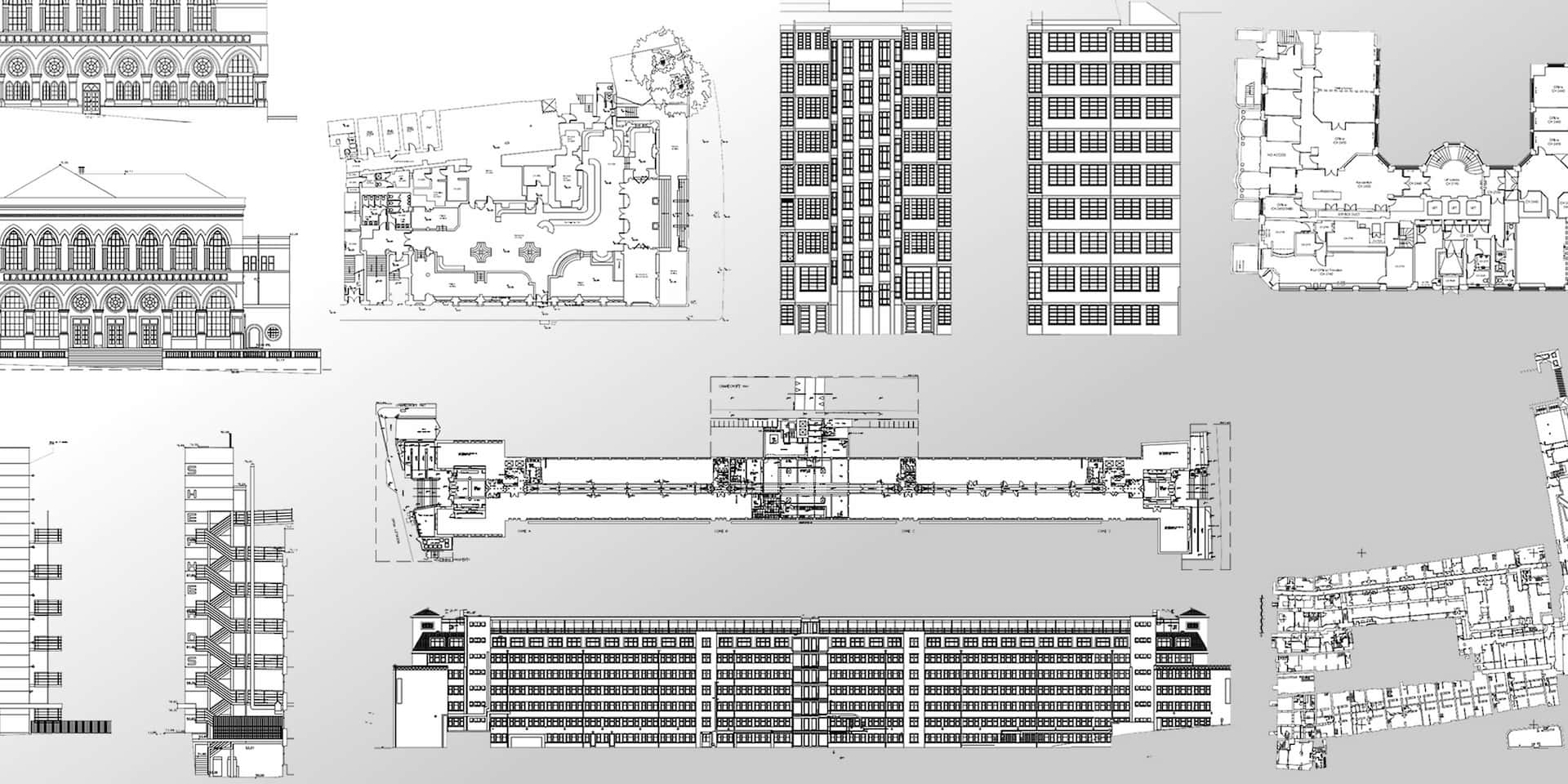
From this data, PointBIM produces accurate 2D CAD drawings in AutoCAD format, typically including:
- Floor plans
- Elevations
- Sections
- Roof plans
- Site layouts
These drawings create a precise record of the building’s form and dimensions.
They form the basis for architectural design, planning submissions, refurbishments and heritage documentation — particularly where a full BIM model is not required.
When to Choose 2D Plans Over BIM
Not every project needs a full 3D Revit model. For many refurbishments, extensions and planning applications, 2D drawings are sufficient.
Common applications include:
- Planning and feasibility studies
- Heritage documentation and façade drawings
- Projects where measured accuracy and coordination are essential but BIM adds unnecessary cost
- Design stages where CAD drawings meet requirements without the overhead of BIM

Our Process
- Laser Scanning – We capture the building in detail using high-accuracy scanners, reducing on-site time and ensuring a complete point-cloud record.
- Data Processing – Scans are registered, checked for accuracy, and aligned to a consistent grid and elevation.
- Drawing Production – From the registered cloud, our team drafts 2D drawings in AutoCAD, following RICS and architectural standards.
- Delivery – Drawings are supplied in DWG and PDF. Additional formats or coordinate alignment can be provided on request.
Deliverables We Provide
- Floor plans (all levels)
- Elevations (external and internal)
- Sections and roof plans
- Site and block plans
- Registered point cloud (if required)
Why Work With PointBIM?
- Over a decade of measured-survey experience across heritage, commercial and residential sectors
- In-house Revit and CAD production for consistent, high-quality output
- Direct coordination with architects and contractors for clear, usable drawings
- Flexible scope — from single-storey properties to large multi-building estates
Frequently Asked Questions
Typically floor plans, elevations, and sections drawn from laser-scanned data, aligned to an agreed grid and elevation.
Get a Measured Building Survey Quote
Send us your drawings and site address - we’ll confirm price, scope and turnaround within one working day.
For direct enquiries: