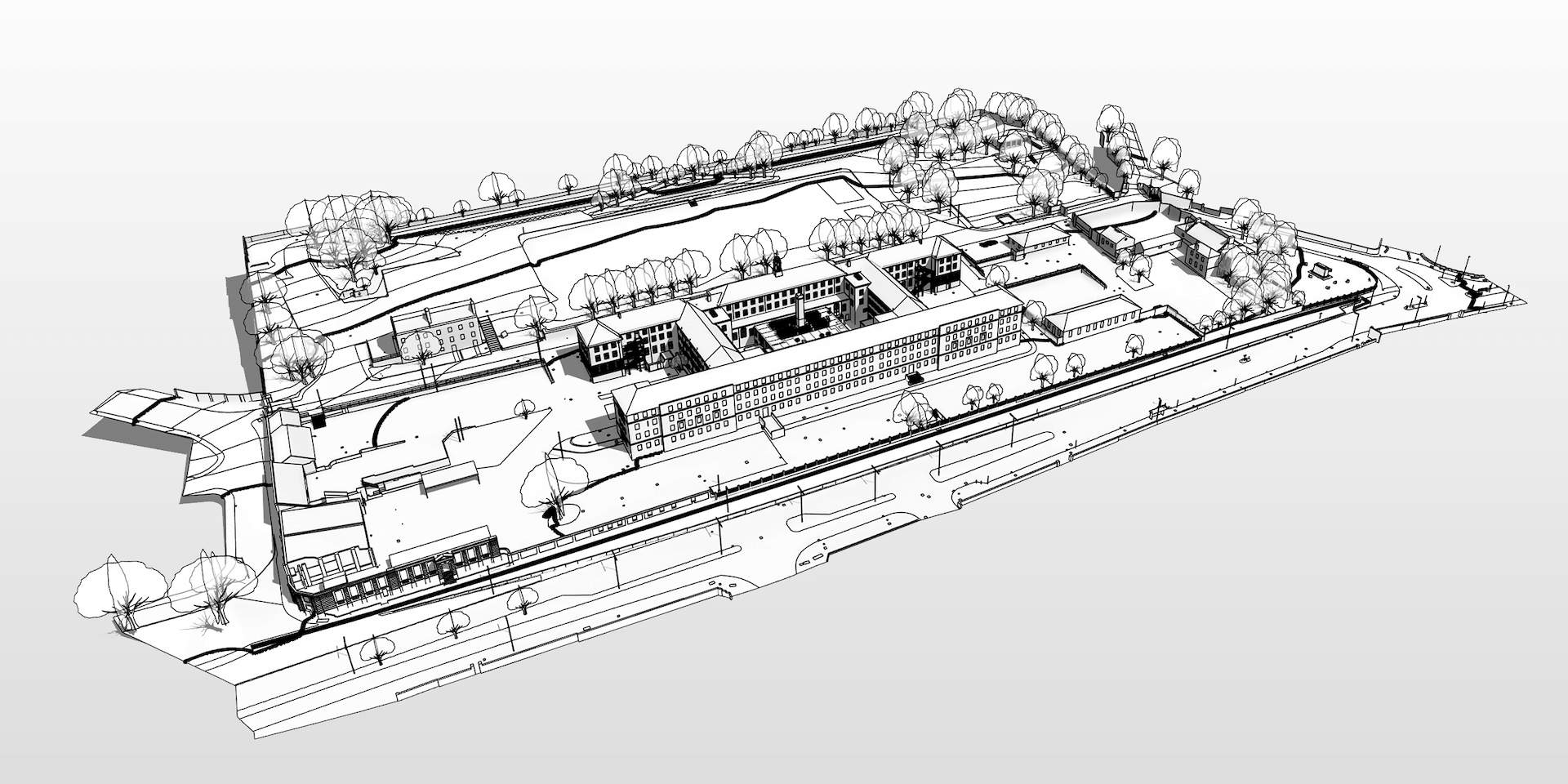
CASE STUDY: Kitchener Barracks, Chatham
CASE STUDY: Kitchener Barracks, Scan to BIM Survey Kent
Location: Chatham, Kent
Brief: Laser Scan Survey & Revit Model
Deliverables: .RVT & .RCP pointcloud files
PointBIM carried out a full measured survey of Kitchener Barracks in Kent, covering 50,000 m² of buildings and grounds. Our laser scans and Revit models provided a reliable record for planning and phased redevelopment.
Project Scope
The client required a full measured survey and BIM model to support the phased redevelopment of Kitchener Barracks in Kent. The site covered more than 50,000 m² of former military buildings and grounds, including several Grade II listed structures.
Our role was to capture a complete and consistent record of the estate as a reliable base for planning and design.
Our Approach
We carried out a coordinated laser scanning survey of all agreed areas, capturing both building interiors and external spaces.
Point cloud data was registered and aligned to a consistent grid and datum, enabling seamless integration across the different blocks. From this, our in-house team created Revit models covering architectural, structural, and topographical elements. Quality checks ensured accuracy against the original survey data.
Deliverables
- Revit models to LOD 300
- Point cloud dataset covering all areas surveyed
- Topographical CAD survey with terrain and levels
- Floor plans, elevations, and sections extracted as required
- Webhosted 360° panoramic photography
Outcome
The client received clear, accurate Revit models and survey data for Kitchener Barracks. All outputs were aligned and coordinated, providing a dependable record of the estate to support design and redevelopment.

Looking for 2D / AutoCAD Drawups in London? See our Measured Buidling Surveys London page
Need a Scan to BIM survey in London? Some of our Laser Scanning → Revit Surveys in London can be viewed below.
Scan To BIM Quote for your London Job →
Send us your drawings and site address - we’ll confirm price, scope and turnaround within one working day.
For direct enquiries:
We can quote your project ↓

