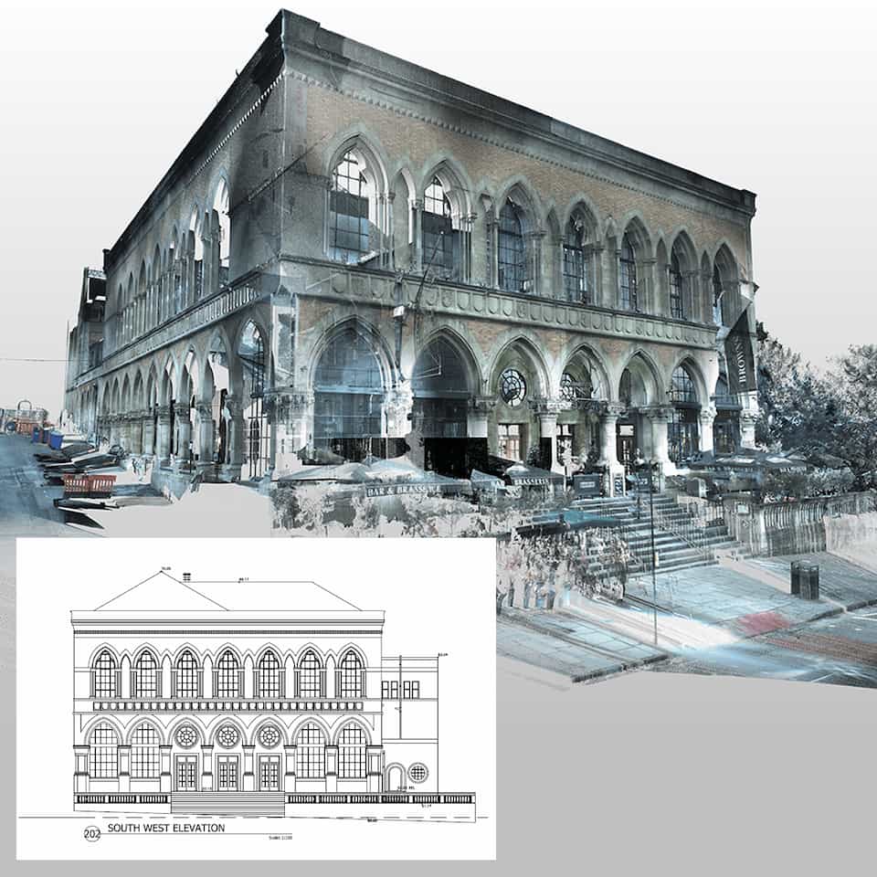
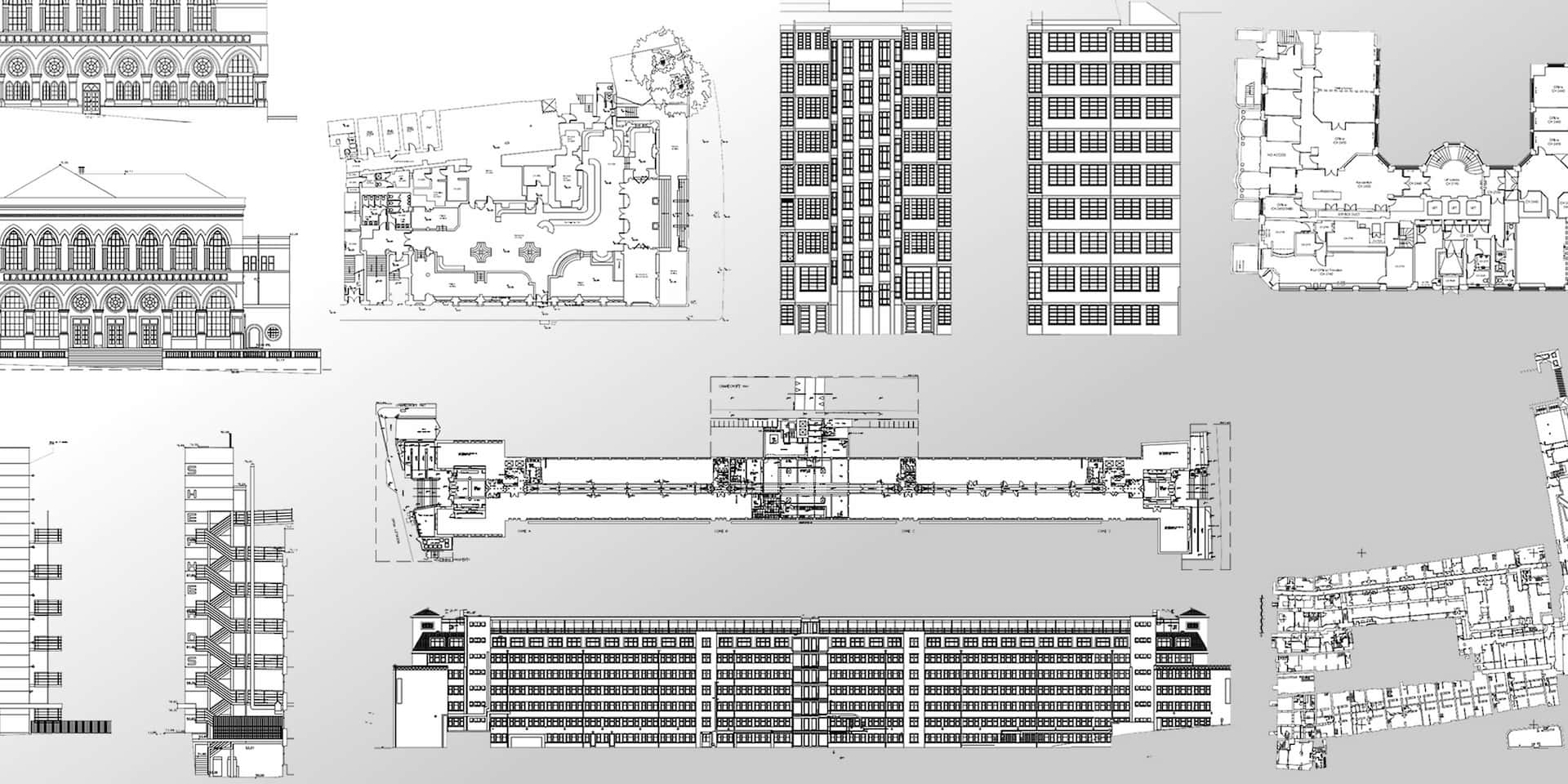
PointBIM deliver accurate Scan to CAD surveys across London. We convert 3D laser scan data and measured building surveys into 2D CAD drawings — providing architects, planners, and contractors with a dependable base for design and documentation.
Whether for a small refurbishment or a full estate, our process ensures the drawings match the building as it exists, reducing errors at the design stage.

What is
SCAN to CAD?
Scan to CAD is the process of taking laser scan survey data — often in the form of a point cloud — and creating 2D drawings in AutoCAD.
This typically includes:
- Floor plans
- Elevations
- Sections
- Roof plans
- Site layouts
These outputs form the foundation for design, planning, or compliance work, and are often required where BIM is not needed.
When to Choose CAD Over BIM
Not every project requires a full 3D Revit model. For many refurbishments, extensions, and planning applications, 2D CAD drawings are sufficient.
Scan to CAD is particularly suited for:
- Planning applications where councils require plans and elevations.
- Heritage buildings where measured elevations and sections are critical.
- Smaller refurbishments where CAD drawings are more practical than BIM models.
- Cost-conscious projects where accurate 2D drawings meet requirements without the overhead of BIM.

Our Process
- Laser Scanning
We capture the building or site using high-accuracy laser scanners, producing a complete point cloud record. - Data Processing
The scans are registered and checked for accuracy, aligned to a consistent grid and datum where required. - CAD Drafting
From the point cloud, our team drafts 2D drawings in AutoCAD, following RICS and industry standards. - Delivery
Outputs are supplied in DWG and PDF, with layouts prepared to client requirements. We also provide sections, elevations, or additional drawings as needed.
Deliverables We Provide
Typical Scan to CAD packages include:
- Floor plans (all levels)
- Elevations (internal and external)
- Building sections
- Roof plans / site layout plans
- DWG + PDF issue formats
- Registered point cloud (if required)
Why Work With PointBIM?
- Proven experience: Over 14 years of measured survey work in London.
- Flexible outputs: We issue drawings in AutoCAD DWG and PDF, with layering and standards to match client preferences.
- Heritage capability: Experience with listed and sensitive sites, including detailed elevation and section drawings.
- Scalable team: From small single-unit projects to large multi-building estates.
Get a Scan to CAD Quote
If you need accurate 2D CAD drawings based on a laser scan or measured survey in London, contact us today.
Contact
LONDON
London SW9 0FN
email: info@pointbim.com
CARDIFF
Cardiff CF10 5DT
email: info@pointbim.com
SWITZERLAND
Bern 3012
email: info@pointbim.ch

